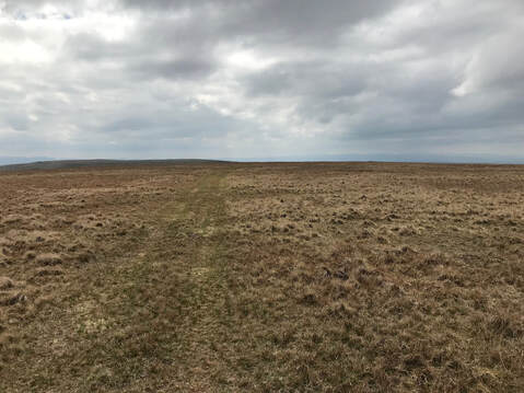
 I parked by Cow Green Reservoir, a lovely , remote spot. South on a track to the dam where the track goes down to cross the nascent River Tees and the track joins the Pennine Way. On throgh Birkdale Farm where invisible dogs howled at me. THe map shows a path branching off towards Maize Beck. THere is an MOD flagpole where this starts - flag down today! - but any path is extremely ontologically precarious. Fording Maize Beck was tricky but not too bad. From here there is a vestigial path to follow on the tedious fence follow that leds to the summit plateau of the Big Hill. Between here and the Wee Hill is some pretty rough-looking terrain but a nice person has made a land rover track that deviates a bit to the right but is very easy to follow. (At one point it hits a gradient I imagine would be rather terrifying for whoever is driving the land rover.) Then back to the mid point of Big and Wee and tediously back down over rough ground to Maize Beck and so home. THe dogs at Birkdale were quiet this time.
0 Comments
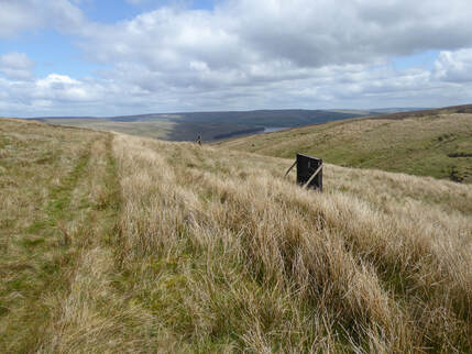 The Nuttalls suggest collecting Three Pikes, Great Stony Hill, Harwood Common, Burnhope Seat and Dead Stones in one big circuit. But I am a less efficient hill-bagger than John and Anne N. are. I was here last year in very wintery conditions and was happy then just to collect Three Pikes and Great Stony. So back again today for the other three. No snow today but very cold and towards the end of the walk a little hail. I was wearing gloves at one point, not a common occurence in May. The car park I used before at the north end of the Burnhope Reservoir Dam seems no longer to be working as a car park with a sign forbidding entry to vehicles but there was space enough by the roadside close at hand. There is a good path, not shown on the OS map, going along the north side of the reservoir and a bridge – two in fact – going across the river at the other end. From here looking at the map there seems to be a way to follow tracks up to just east of the top of Scauld Hill. On the ground it didn’t quite seem to work. Good tracks did take me up to where the map shows a track following a stream called Crooked Sike but this more or less petered out on me. From here I could make out the grouse butts marked on the map a little to the west so I headed up that way. It was rough going, mostly pathless, occasionally something vestigial . Approaching the top I did find the track again as it crossed the fence that follows the broad ridge between Great Stony Hill and its western neighbours. 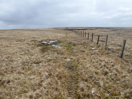 From this point on the game was one of following a fence along more or less pathless - again occasionally something vestigial- boggy ground. But not too boggy, nowhere near as horrific as I recall Three Pikes to have been. The top of Scauld Hill is bang on the line of the fence. The top of Harwood Common is a short walk to the south of it. The trig point of Burnhope Seat is slightly to the right of it. The Nuttalls are happy enough that this is the top but – oh no! – I discovered only afterwards that the hillbagging website disagrees and claims there is a higher spot a bit over to the west. Now my conscience must struggle. Can I claim the bag or must I visit it again? Ayway on I went, following the fence north to Dead Stones whose name could be a Joy Division track. Is quite a bleak spot maybe but not that bleak, decorated with a massive cairn on its summit. I was now following the Nuttall route so my next destination was the trig point on Highwatch Currick, another long bogtrot along a pathless fenceline. From the trig point the Nuttalls direct us to pick up a track (not on map) and follow it to where it turns left through a fence, at which point leave it and head downhill towards a corrugated iron building where another track leads quickly to the road near the dam. Slightly confusingly there are to such buildings in view. You want the one on the right. These are little visited hills. I met just two people the whole way on a May Bank Holiday weekend. But once a busy working landscape and still peppered with a few open, sometimes unfenced, mineshafts, something to be careful of, especially if walking alone. 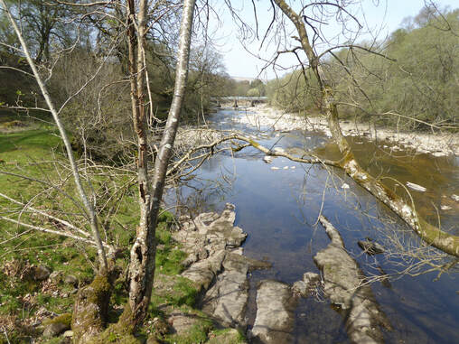 Another Donkin walk on the Pennine Way linking the Lambley and Thirlwall Castle walk which I did last February and the South Tyne and Alston walk which I did yesterday. This is a similar deal, South Tyne Trail one way, Pennine Way the other. I parked at Slaggyford Station where I also had a cup of tea in the Buffet Car, a small very basic tea ship which is also a – not very mobile – buffet car. Then down the railway line footpath to Kirkhaugh, picking up the Pennine Way where I left it yesterday. From here to Lintley the Way is a field path which lots of sheep to meet. Then it goes under the viaduct back to the east of the railway and becomes a riverside path along the bank of the Tyne back to Slaggyford. There were places hereabout that might be tempting spots for a swim. 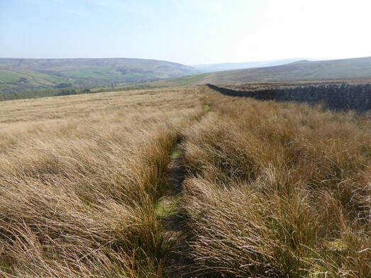 North of Slaggyford the Way follows the South Tyne Trail – no longer a railway now – for a bit then branches off, through the policies of Merry Knowe Farm. then follows fields to the crossroad at Burnstones. Now it climbs up onto the moors to the west and follows them north, picking up the line of the Maiden Way, a Roman Road. Rather lovely up here. Near Lambley I left it and crossed some fields into the village. (By one of these odd footpaths which goes right through somebody’s garden.) From the village a path leads down to the viaduct where some incoveniently situated private property means the South Tyne Trail walker must descend to the foot of the viaduct and then climb laboriously back to the top almost at once. Again a very straightforward walk down the Trail and I was back at my car. 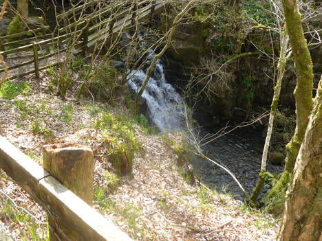 This is another of the Donkin Pennine Way circular walks. I parked in the middle of Alston and headed off down the Natrass Gill path which comes off the main street just where the Weardale and Teesdale roads branch apart. This path rather shadows the Pennine Way which runs parallel just a short way to the west. Indeed towards the end approaching Bleagate Farm past Woodstock I strayed a bit to the west of the path and found myself joining the Pennine Way early bypassing the Bleagate farmyard. Then back north to Alston a bit nearer the river – I saw a red squirrel hereabouts – until a woodland path brought me back into the town by the bridge over the Tyne. Crossing the bridge leads to the edge of the village where there is a war memorial and another branching of roads as the A689 to Brampton joins the A686 to Carlisle. 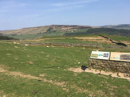 The Pennine Way here heads past a house and over fields to join the drive of Harbut Lodge and meet the A689 again, then climb up the other side and make its way north for a bit up on the moors passing the old Roman fort of Epiacum (Whitely Castle). You know you are passing Epiacum because there is an information board. There is not a lot else to see. Here the Pennine Way coincides with one of many lesser known walking trails, Isaac’s Tea Trail names after an itinerant tea seller Isaac Holden – the more famous Isaac Holden, the Scottish inventor, industrialist and parliamentarian was his cousin. The ways part at Kirkhaugh, problematically for the Tea Trail which crosses the Tyne here using a bridge which, some signage advised me, is not currently in working order. Donkin has alternative routes back to Alston from here. One relies on the defunct bridge. The other simply follows the railway along a path which he describes as “uncomfortably narrow”. I guess it has been improved since his book came out as the description fails to match reality and I walked the last two or three miles back in perfect comfort. 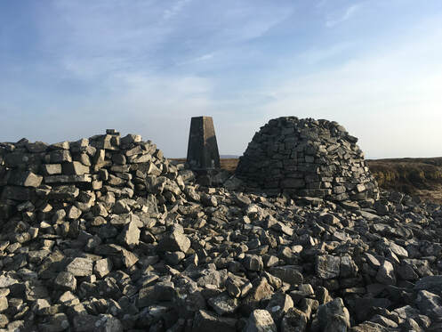 I parked at the Geltsdale Nature Reserve car park just south of Clesketts. A track continues south past a cottage at Tortie and a bunch of cottages at Howgill. Here I went left and then right to pick up the Bruthwaite trail which leads to a viewpoint some way below the ridge between Currick and Cold Fell. The track carries on towards Currick but I left it to cross the Howgill Beck just above a waterfall. From here it is a rough bogtrot on pathless ground to the summit where there is a trig point a cairn and a rough shelter. A path heads NE towards Currick. Perhaps if one went this way one could have a path underfoot the whole time but I cut the corner returning more directly to the Bruthwaite viewpoint and so home. |
|
 RSS Feed
