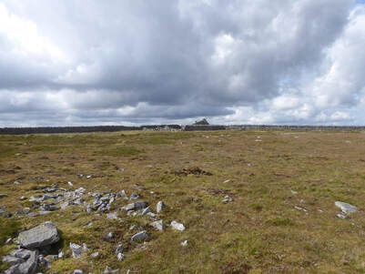
 There is a small layby thing across the road from Castle Nook Farm. I parked here and headed into the weeds where the Pennine Way is signposted. It emerges from the woods above the farm and heads over pasture. I deviated a bit to avoid some cattle and found myself on strange terrain, the ground moulded into an array of small ridges. It soon dawned that this was manmade, the remnants of the old Roman fort of Epiacum. I kew this was here but I had clean forgotten. I kept on the Pennine Way crossing the Gilderdale Burn. A little after this, just before it turns left towards Harbut Law, there is a track heads off southwest. This follows the valley along the line of a fence, getting a bit intermittent as it apprached the head. Finally the fence comes to a T-junction by some ruined sheepfolds. After this it is pathless to the top of Black Fell. From here over Tom Smith's Stone and onto Grey Nag is a long boggy fence following exercise with occasion signs of a vestigial path, utterly typical of the North Pennines. The energetic could lengthen this walk with a long detour out along a ridge to the west to collect the newly promoted Nuttall of Thack Moor. Not me, I'll come back for it another time. Before Grey Nag the ridge passes Tom Smith's stone and the barely noticeably bump in the ridge that is the hill named after him. EVen with the mighty resources of Google I cannot find out who Tom Smith was. From the top of Grey Nag I headed off over more pathless ground down the ridge to the northeast labelled Great Heaplaw on the map. A long trudge over little visited hills meeting not a soul.
0 Comments
|
|
 RSS Feed
