| Jimmy Lenman |
|
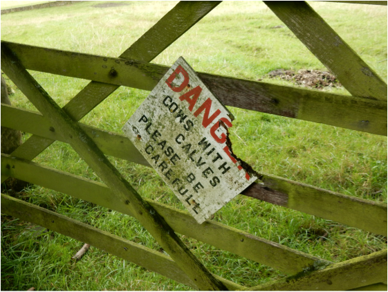
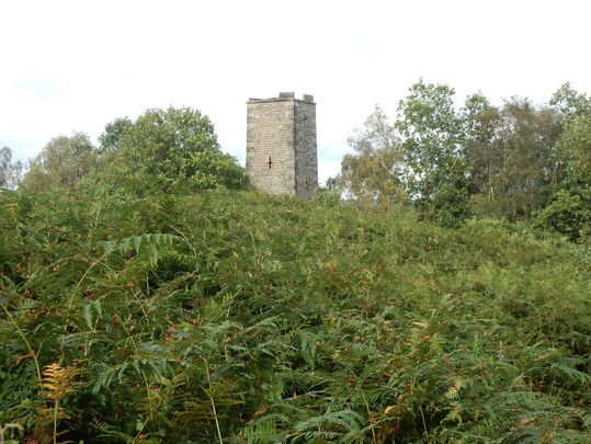
 With Barbara and Jessie. We parked up by the road from the corner from the big Peak Village Shopping Centre and walked round to the Peacock where we turned south down Woodhouse Lane. We followed this as it swings sharply right but a bit later when it swings left we kept straightish on taking the right of way that leads across the fields to Congreave. The biggest of these fields was home to lots of cows with calves and a very large bull which made me slightly nervous with the dog in tow but they all cheerfully ignored us as we passed. Coming out at Congreave a sign on the gate saying: “DANGER. COWS WITH CALVES. PLEASE BE CAREFUL left is in no doubt how brave we had been. From Congreave we climbed steeply up the road to where a footpath on the right sut a corner over some fields to meet the road leading towards Stanton. We were looking for a path off right climbing along the edge of the woods. After a short walk along the road there was a finger sign but ity wasn’t clear whether it was pointing – a bit oddly – straight along the road itself, or – a bit alarmingly through the gate of the first property on the left with a bit sign advising being wary of the dog. We stuck cautiously to the road and after a bit another finger sign pointed unabiguously up into the woods. Following this led to Lees Road just by Stanton Moor but it had been such thirsty work getting here that we decided we would pop down to the pub in Stanton for a bit of sort liquid refreshment. It’s actually quite a long way down band a very long way back up but the pub – the Flying Childers – is lovely and well worth a rather steep detour.  Back up onto Lees Road one soon comes to a place where a lot of cars are parked and a good path leads off over the moor towards the Nine Ladies, the most famous and most visited of several Peak District Stone Circles. We then had a good old wander round the Moor, taking in the Nine Ladies, the trig point, the Early Grey Tower built to commemorate the 1832 Reform Act. We looked for a path leading down. We looked for a footpath near the tower that would lead down to connect with the path through Stanton Woodhouse Farm- there seems to be one faintly shown on the map – but failed to find one so headed back to the Nine Ladies and on north. Ting got a little confused round here not helped by the fact that I had managed to lose my map by the point and we were now navigating with the help of Barbara’s iphone. But we soon found ourselves on the path leading to Stanton Woodhouse. The path is at first a bit overgrown but soon turns into a beautiful broad grassy track leading up past the farm. This is a rather grand affair, once apparently a shooting Lodge belonging to the Duke of Rutland. A scary looking dog barked at us as we passed but seemed safely confined and failed to tear us limb from limb. The rst of the walk is down the access track to the farm which is a properly tarred road and soon we were back in Rowsley ready for a quick drink which the highly salubrious Devonshire Arms in Beeley soon supplied us. I’d been on walks onto Stanton Moor before but from Winster and Birchover to the south. But from Rowsley too it makes a lovely walk.
1 Comment
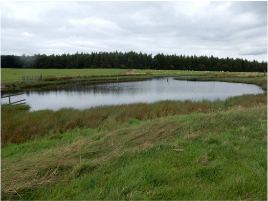 With Barbara and Jessie. There was some kind of big show on at the Bakewell showground so the parking by the bridge was getting pretty crowded but there is loads of it and we found a space. Out of the car park you turn right down Coombs Road looking out for a slightly dilapidated finger sign pointing off right. This leads down a lane and over a field which on previous occasions has been full of alpacas but today was more prosaically inhabited by sheep, across a bridge over the Monsal Trail, over the golf course and steeply up through woods, ignoring tracks braanching off right to reach the wonderful green upland that is Calton pasture, one of the very loveliest places in the Peak District. The path here climbs gently up to a little pond and then descends gloriously towards Calton Houses but, instead of getting very close to these, veers off right of them and enters some woods just by a big barn. A short walk through these woods brings one out on Capability Brown designed Chatsworth Park. Once here we wandered down to the House where Barbara bought us both a pot of tea and some very tasty ginger biscuits. A walk that takes in Chatsworth can always and should always be a civilised affair. From here back to the bridge and down the west side of the river as far as Calton Lees. Right here past the carpark and the garden centre, then a sharp ;eft at the houses brought us out on the Derwent Valley Heritage Way leading towards Rowsley. For about a mile this led through pasture, past a herd of placid, relaxed cows, then turned to woodland and we were soon at Rowsley coming out on Church Lane. Right up this and on up the hill following a track that climbs gently up into the woods, along a bit, down past Bowling Green Farm to a riverside path that leads easily and pleasantly back to Bakewell. Things got a bit noisy as we came through the show ground where there was a big noisy event (subsequent investigation online leads me to suppose this was the Bakewell Baking Festival though by this time there was little evidence of baking) but we were soon back at the car and on the way home, stopping at the Fox House for a much needed drink. Another real Peak District classic. 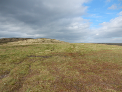 With Jess and Mark. We drove to Crowden where there is nice free parking. A sign here tells us about the estimable Moorlife 2020 conservation project hereabout generously funded by, sigh, the European Union, I guess not for much longer. To get to the Pennine Way one heads left in front of the farm buildings past the campsite and one soon meets it coming in from the west and signposted north. Directions from here: follow it to top of Black Hill. Straightforward. Impossible to miss. There is a bit of a climb up by Oakenclough Brook to reach the plateau edge above Laddow Rocks. From there it’s a long trudge over the plateau pleasant enough on a nice day like this but probably a but horrible in thick weather. A man on the top was looking out for a party of Duke of Edinburgh expeditioners he was meant to be assessing of whom there was no sign. They finally asppeared just as we were setting off again and more or less followed us down. Our path down, southeast then south over Tooleyshaw Moss was not easy to spot by findable sooner or later by following the lines of cairns marking it. On it goes over White Low and Westend Moss. About here it branches, the right branch heading more or less directly down, the left heading to the trig point on Hey Moss. (This is not marked on the Landranger map and on the 1.25,000 map is oddly marked by the word “pillar” and not the usual symbol.) When we got to the pillar the path had more or less vanished so we decided to head left across country and pick up the right branch we had originally eschewed. This proved hard work, only about 300m but across some really filthy terrain. Finally we were on our path which we followed easily enough down to the road at the little church east of Crowden and back up the busy A628 (there is a pavement, mercifully) to the village. 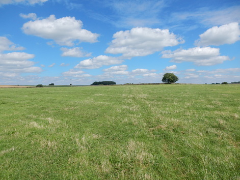 With Barbara. We started at the rather full car park at the Monsal Head Hotel and walked down the steep slope to the viaduct. Across this then down again into Monsal Dale which we followed upstream to the A6. We crossed to the carpark where a footpath leads diagonally uphill. This branches more than once as other paths head off towards Taddington and into Great Shacklow Wood but our path for Deep Dale was signposted at these branch points and easy enough to find. Deep Dale is a lovely gentle climb up a steep sided valley towards the high pasture country round Sheldon. A couple of relaxed recumbent cows ignored us towards the top. Eventually we came out onto a road by the access track to Over Wheal Farm. A little east of here a field path cuts a corner heading towards Sheldon. The first field it crossed was full of cows the closest of which to the entry point glowered and pawed the ground a little ominously for our taste so we stuck on the road till the next field along which we walked up to regain the path. Slightly perversely, having done this, instead of carrying on to Sheldon, we went right at the road past Johnson Lane Farm, left at the meeting of roads and approached Magpie Mine over fields from the west. We didn’t have the place to ourselves. Some young men with very fancy photographic kit were there taking pictures of a young women. We left them to it and headed over the fields to Sheldon, stopping for a little refreshment at the lovely Cock and Pullet. 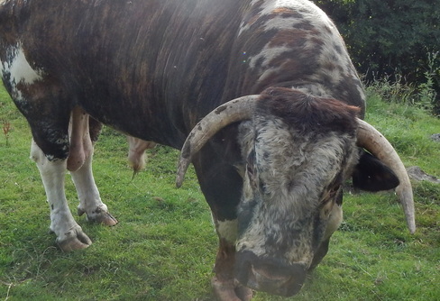 Then past the church and down the hill where a very steep path through the woods has been carefully engineered into a staircase. From the foot of this it is a lovely walk through the woods by the river to Ashford. We crossed the bridge and walked up Fennel Street and Vicarage Lane. Near the top of the latter a short path cuts a corner onto Greaves Lane and then heads north over fields t the Monsal Trail. The first of these fields brought the most exciting moment of the walk as it was full of huge English longhorn cows. These have a good reputation for docility but a terrifying appearance and, yes, that one at the top of the field, standing right slap bang next to the gate we needed to go through to get out of it, that was the huge and terrifying-looking bull. Anxiously, very quietly, we walked past him and through the gate and then on, without further excitement to the Monsal Trail. Here almost at once a path branches off right towards Little Longstone which we didn’t take. Half a kilometre further, the map seems to show another path crossing the Trail but don’t be misled – we were and got a little confused – it doesn’t, the Trail is entering a tunnel at this point and this path doesn’t connect with it. But our confusion was shorty-lived and we were soon back in the comfortable and civilized Monsal Head Hotel after a classic White Peak walk in glorious weather. 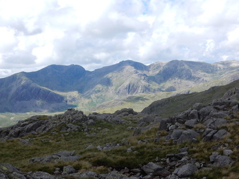 Another walk from the Old Dungeon Ghyll Hotel that can be done without troubling one’s car. I set off across the fields through Stool End Farm and over the bridge to where the path to Red Tarn starts its long steep climb. Just before Red Tarn there is a path branches off to the left leading to Crinkle Crags. Just to do these would be a pleasant shortish day and may people go on and include an ascent of Bowfell to make it a little more challenging. I had a different plan to add a little extra to the simple Crinkle Crags walk which was to sweep up the associated Nuttalls. Not Pike o’ Blisco which I climbed rather recently (103) but Great Knott, the three Tops of Cold Pike and Little Stand as well as the four Nuttalls involved in traversing Crinkle Crags and Shelter Crags. Great Knott is very easy. You just keep going along the oath towards Crinkle Crags until it passes very near the summit which you make a short stroll out to visit. Finding one’s way across the three tops of Cold Pike in poor visibility would be tricky I guess but was easy enough today in clear weather. The main top when you found it is anyway hard to mistake a lovely rocky amphitheatre with a good cairn. The same cannot be said for the West Top where the top is marked by three stones on a lump of rock. The far flung little nodule of Far West Top has more of a cairn. I headed west from here and up grassy slopes onto the ridge between Crinkle Crags and Little Stand. There’s a faint path and it doesn’t take long to reach the ridge and walk along it to the summit cairn where a wonder view across to the Scafells opens up. Then north back up the ridge until eventually I rejoined the main Crinkle Crags path just before the ascent of the first Crinkle began in earnest. 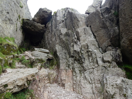 Over this I went and down to the col before the main top where I was confronted with the famous “bad step”. This is eminently avoidable by a very clear path that heads off diagonally up right but I thought iI would give it a go. Really it is not so bad. You climb it using the big flake in the centre of the picture which provides first of all an extremely positive handhold and then a reassuringly large and secure foothold. The transition from the former employment of it to the latter is the only very slightly awkward move and is likely to induce an undignified noise from anyone much over 45. Really not hard, it might perhaps be a bit daunting in descent. That bit done, the rest was a stroll, up over the main top on Crinkle Two and then delightfully on over further crinkles, the two tops of Shelter Crags and easily down the lovely broad ridge of the Band. |
|