

| Jimmy Lenman |
|
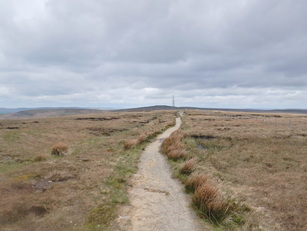
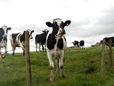
 With Graeme. We parked on the A62 by Brun Clough Reservoir and followed the Pennine Way noth over the three trigs of Millstone Edge, White Hill and Blackstone Edge. It was raining when we left the car, blowing a gale on top of MillstoneEdge but by the time we got as far as the motorway crossing before Blackstone Edge it was much improved and it stayed that way. Just past the Aggin Stone we abandoned the Pennine Way and came down the old Roman road to Lydgate. From here a track gives easy walking south down to another motorway crossing. Just before this we passed through the grounds of a house perched right above the motorway and fully exposed to all the noise of cars and lorries thundering by. That would be a tricky house to try to sell.  We turned right after the motorway and headed downhill past some building where a sign told us “Beware Guard dogs. Do not stop.” I hate that. This is a public right of way, people. Dogs that need bewaring of and intimidating signage advertising their presence have no business on it. In any case we passed by safely enough today without the dogs eating us. A bunch of cows with calves grazing by the track by the derelict mill at the bottom of the hill ignored us placidly. Here we doubled back left along the Pennine Bridleway. When it doubled back again right we kept straight on to cut the corner towards Tunshill Lane. The paths are quite a confusing tangle on the map here and it’s not easy to match them up to what is on the ground. But we followed a path that climbed the hill above the track just east of the valley between Nicholas Hill Pike Ben Heys to reach the meeting of ways below Turf Hill. It is rather delightful around here, by the way.  From here it was very straightforward going on a good track past Piethorne Reservoir to the Ram’s Head Pub on the A672. The least pleasant bit of the walk now followed this south into Denshaw but there were verges to walk on so not so bad. We followed Delph Road south from Denshaw and turned left down Wham Lane, continuing on Ox Hey Lane past the llama farm. A big groups of cows in a field on our right got very agitated about our presence as we passed them. We saw there was a right of way signpost pointing right across their field and were very glad that wasn’t where we were going. Anyone following it today would be braver than us; happily we were headed east. On down Low Gate Lane we went and over the dam on Castleshaw Upper Reservoir. It’s not far from here but it is relentlessly uphill which felt quite punishing at the end of a long walk(17½ miles according to Donkin’s Pennine Way book), past Bleak Hay Nook and round the big looping track above Globe Farm back to the carpark. Then back to Sheffield for a curry.
1 Comment
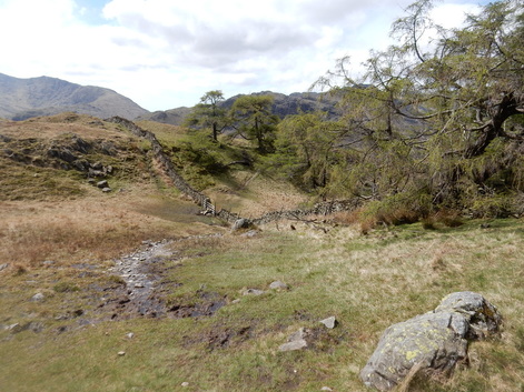
 With Sophie. The best day of the May Bank Holiday weekend and Langdale was teeming. From the National Trust Car Park we crossed the road and took the track to Side House. After that a field path links ladder stiles to where the path is met that heads uphill cutting a corner of the road over to Little Langdale. From here a good path contours round Side Pick to follow a fence to the col between the latter hill and Lingmoor Fell itself. Then another good path follows a wall to the top. The fabulous view encompasses, Swirl How, Weatherlam, Pike o’Blisco, Crinkle Crags, Bowfell, The Langdale Pikes, Helvellyn and Fairfield as well as much of Windermere. We came down by following another wall southwest to take the easy to find path that climbs down to the left of a little gorge to Bleatarn House. From there we more or less reversed our upward route before grabbing some coffee and cake at the very busy Chesters at Skelwith Bridge before driving back to Sheffield. This is a lovely short hillwalk. With Sophie. Things not to do in the Lake District when the rain puts you off the fells. Don’t go to the Alpaca Centre at Stainton. We did just that and were told that the alpacas, who don’t like the wet, get shut away indoors on rainy days. So we needed a plan B and thought we’d go look at Lowther Castle. This was a much better idea. The castle is a ruined shell and what’s left of its interior is closed off. But the grounds are wonderful to ramble around, especially the path along the top of Burtree Scar with wonderful views down the Lowther Valley. After so rambling we checked out the tea room which we found dispiritingly deserted on this May Bank Holiday lunchtime. Friendly staff did us a pretty nice lunch and some decent coffee and it didn’t seem fair they were so quiet. At which point we noticed how nice the weather had turned and thought some kind of walk in order. A short drive down the road to Askham took us to the start of s seven mile circular walk in Wainwright’s Outlying Fells (or the Wainwright Geriatirics, as it is hard not to call it). This turned out to be an utterly delightful walk that climbs the easy hill before taking a turn around Divock Moor where the grassy conditions underfoot are so easy it’s like walking on a carpet or a suburban lawn. After going pretty directly to the flat top of the none too spectacular hill, with fabulous views down Ullswater, we followed AW’s directions north to Heugh Scar then south for about a mile to the first of two ancient stone circles this walk visits. The second is about another mile southeast just before the conspicuous Copp Stone rock. From here it was an easy stroll north then north east back to the car. A tasty meal in the foodie pub at Yanwath rounded off a pretty good day. (I could have had some nice pictures to show for it all had not my camera continued to malfunction.)
With Sophie. From our b & b near Windermere we drove over the hairy and spectacular 1 in 3 gradients of the Wrynose Pass. I thought this was bound to impress Sophie but she told me there were much steeper and more spectacular mountain roads back home in Norway. Which was me told. We parked up at the car park near Birks at HInning House Close and took the path to Birks. Right here onto the path that makes a rising traverse through the woods which we followed to the gate in the fence at the forest edge just shy of a kilometre short of the Hardknott Pass road. All the time in light but pretty unrelenting rain. Then we followed the fence south as far as the stile in the fence which which joins it from the west. From here the path that skirts to the east of Demming Crag towards the summit of the fell is boggy and a bit vestigial but not to hard to follow if you pay attention. We were maybe a kilometre short of the top when Sophie found herself feeling rather poorly so we gave it up. The fell won’t be going anywhere and there’s always another day. Maybe next time a different route and not this rather exasperatingly indirect zigzag along the two longer sides of a triangle.
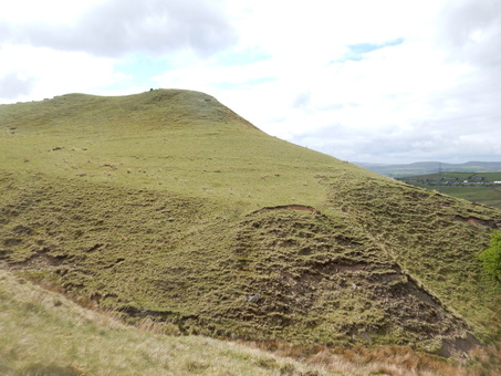
With Sophie. We got into the Lakes a bit late for any sort of long walk so this little hill seemed a nice plan. It was walking up here from Windermere Station that gave Wainwright a first view of the Lakeland Fells that inspired his lifetime’s work writing about them and he includes it in his Outlying Fells. Wainwright’s directions there are not much use as the way he takes is not now a right of way. Round the corner to the east of the hotel there is a signposted permissive path starting through a gate where a sign warns one of the presence and possibly aggressive behaviour of bulls and nursing cows one is liable to meet beyond it. We went through this and up a couple of fields beyond it, without a cow anywhere in sight to reach the woods where the well signposted path took us very easily to the top. Then still more easily down by the right of way down the much more crowded path then track that leads back to the road just west of the hotel. Even on a slightly overcast day, the view was everything Wainwright says but alas a fault in my camera means you need to take my word for it.
|
|