| Jimmy Lenman |
|
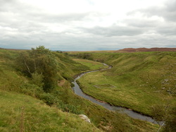
 The A66 is a bit of a theme for this walk. You can see it rather a lot of the time and you can hear it a fair bit. It definitely felt like autumn today. There were dead thistles everywhere. I followed the Pennine Way out of Bowes by the castle , over fields and past Swinholme Farm where they seem worried about crime, barbed wired on the roof, metal grilles on the windows. On through fields and past more farms to East Mellwaters where a sign notified me that the rights of way have been moved around a bit. There is a path on the map here that cuts a bit of a corner on the Pennine Way but it looked like it no longer exists so I took the long way round. No great hardship. And so on southwards past Trough Heads and along above Sleightholme Beck down to the road and past Sleightholme Farm. A lost-looking man on a motorbike here asked me if the way I was headed was motorable over to Tan Hill. I told him I thought it probably wasn't. (It isn't.)  Now the Pennine Way follows a track for a mile or so till just after a bridge it turns off and becomes a faint boggy path (not motorable) all the way to the Tan Hill Inn. The inn looked very tempting. I should probably have thought to carry some money with me. And so back, down the Long Causeway, for two and a half miles, with lovely views down towards Arkengarthdale, to the track signposted to Bowes, and back across the moors to rejoin the Pennine Way and follow it past Sleightholme Farm again then leave it again and stick to the admirably sleepy traffic-free road up past Bar Gap Farm and on and finally back to Bowes.
0 Comments
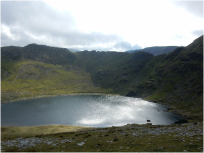 I started from the Glenridding car park: £8 to park for the day and they still charge you 20p to use the loo. And while the machine is meant to take plastic that bit didn’t seem to be working today so be sure you have plenty change. Over on the left bank of Glenridding Beck, signposts for Helvellyn lead past the campsite and up the valley. After a bit there’s a sign saying the public footpath crosses the bridge so I did. A faint path heads left upstream immediately after the bridge. Don’t make the mistake of following this as I wasted a little time doing. You want the road to the Youth Hostel a bit further on. Reaching the Youth Hostel I went right through the car park, past the old Greenside Mine works, and crossed the Beck again. A path from here climbs steadily up towards Red Tarn. Shortly before the Tarn I left it and headed up the east ridge of Catseye Cam, a straightforward grassy climb. The view that opens up here is quite wonderful, with Red Tarn shining in the September sunshine framed by the glorious horseshoe of Helvellyn and its two edges, Striding and Swirral. 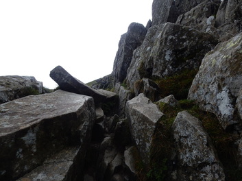 Swirral Edge came next which is delightful and straightforward. The wee rocky nobble near the base is turned by a path on the right (facing Helvellyn) and at the short fun scrambly bit near the top the ridge is broad and there is little feeling of exposure. And so to the wonderful place that is Helvellyn's summit. Beautiful, inviting paths head off from here in every direction. Mine was easily northwest to Helvellyn Lower Man, then north to White Side and northeast to Raise and on to the head of Sticks Pass. From here a good path goes towards Glenridding which I followed as far as the quarry tips where I left it for a fainter path up Sheffield Pike. Sheffield Pike looks tiny from its much higher neighbours, rather less tiny from down here but it didn’t take long to reach the summit on the often rather boggy path. 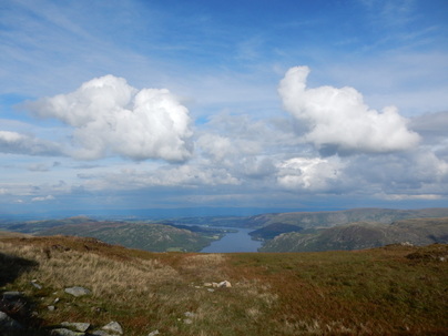 “Even on a sunny summer day,” writes Wainwright of Sheffield Pike, “the top of the fell seems a dismal place…” On this beautiful September day this assertion seemed wildly, perversely untrue. I could have sat there forever enjoying the sight of Ullswater stretching away north. But there was a descent to be done. A path leads down the southeast ridge to a tarn where it steepens dramatically and descends a little vertiginously to the col before Glenridding Dodd. From here a path heads off to the right zigzagging down through steep heather back to Glenridding. 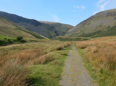 “Earlier civilisations seem to have shunned this area,” write the Nuttalls in their Mountains of England and Wales (Vol 2, p. 232), “and there are no ancient settlements or roads…” So it comes as a surprise, a few minutes after crossing the bridge by the Cross Keys layby on the way to Cautley Spout, to find a sign from the National Park Authority informing us that: “Archaeologists have discovered the houses and fields of an iron age farming community in the valley below. These people probably lived by grazing sheep and cattle and growing a few crops in the tiny enclosures close to their simple stone and timber round houses.” The Nuttalls also offer some words of reassurance for the cow-timorous here: “Cattle, including often a docile bull, graze by the footpath beside Cautley Holme Beck…” But of cattle, or indeed evidence of cattle, docile or otherwise, there was today no sign. 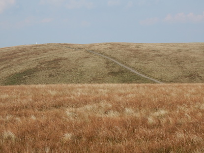 When the path reaches the fellside it divides. The right branch goes off towards the pass between the Calf and Yarlside, the left goes up the side of Cautley Spout. The latter path as one approaches it looks alarmingly vertiginous. At close quarters it turns out to be rather highly engineered and quite literally a walk up a staircase which leads easily and occasionally spectacularly to the grassy Howgill uplands. Here I followed the valley of Red Gill Beck to the top of Calders. From here it is a romp on a good path to the top of the Calf with a short detour to take in Bram Rigg Top. And from here a straightforward descent to Bowderdale Head and thence down on the right branch of the fork in the path where I’d gone left on the way up. A nice short afternoon walk in lovely late summer sunshine. 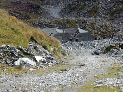 I started from the carpark in the centre of Blaenau Ffestiniog just by the elegant public loos that used to be a railway ticket office. The Nuttalls directions to Moel Penamnen say you should first follow a road at the back of the carpark “leading steeply uphill through slate spoil with high retaining walls on either side.” I’m pretty sure I took the right road but high retaining walls were conspicuous by their absence leaving me a bit uncertain This, the Nuttalls tell me, leads into the disused Maen Offeren Quarry. It certainly led to a quarry but there seemed to be a bit more activity than I would expect were it entirely disused. At the back of the big open area was a track leading uphill. On the right on this was big sign saying, in Welsh and English: SITE SAFETY ALL VISITORS AND CONTRACTORS MUST REPORT TO MAIN OFFICE CHILDREN MUST NOT PLAY ON THIS SITE No access for unauthorised persons DANGER Quarry workings KEEP OUT High visibility clothing must be worn Foot protection must be worn Head protection must be worn Speed limit THINK SAFETY! AVOID ACCIDENTS. On the left there was a much smaller public green and yellow public footpath sign. A bit tentatively, hoping I was not about to be shot or mauled by guard dogs, I carried on. I soon came to a place where another public footpath sign pointed uphill through thick rhododhendrons, just as the Nutalls advise, so I followed it up, finding it, just as they say, a tad overgrown. This leads, again as Nuttalls say, to a ruined winding house with cable and drum. At which point I encountered the day’s second discouraging sign. This one says, in very faded letters, again in Welsh and English: Public footpath ends here. Please return along footpath. Looking at the map there look to be two rights of way that don’t quite join. But what the Nuttalls say is OK is surely OK so I scrambled over a pile of old slate blocking the way and carried on north east to reach again as advertised by Nuttalls, another ruined winding house. This brought to an end the rather fraught first stage of the walk which all felt rather like I was trespassing on a not very safe industrial site. Now it got much better. 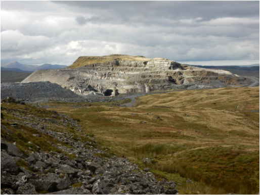 It was a bit of a boggy trudge north towards Moel Penamnen to a point where a path is visible climbing a steepening leading to the ridge. This was soon reach and climbed and it was easy going to the cairnless top. From here to Foel-fras is a lovely pleasant grassy walk and from here it is a straightforward fence-following excerise, sometimes with a path of sorts underfoot, to the North Top of Manod Mawr. Getting from here to the main top requires circumambulating a gigantic hole in the ground caused by more quarrying operations. Now the descent to Blaenau was straightforward. Down the northern slopes to another quarry (this one looked properly disused) and follow the old incline system back into the town. 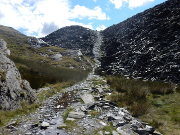 A sign by a gate as you leave the village of Croesor prohibits the presence of dogs. The path up Cnicht from here is well signposted and easy to follow: rising steadily with wonderful views south over Carigan Bay until a final steepening which is quickly over. From here again it’s easy finding a way north over the North Top to Lyyn yr Adar where I took a right at a cairn. The path from here to Bwlch y Rhosydd is a bit come and go but the ruined buildings of Rhosydd Quarry were a clear enough target to aim for. From here I climbed a couple of old inclines to take me back onto open moor where a faint but pleasant path took me to the beautiful summit of Moel-yr-hydd. After descending this a bit I picked up a path which a very faded sign advised me was “in dangerous condition” to go round a huge hole in the ground to reach the summit of Moelwyn Mawr North Ridge Top. I since learn this was deleted as a Nuttall earlier this month but it is a nice spot nonetheless. 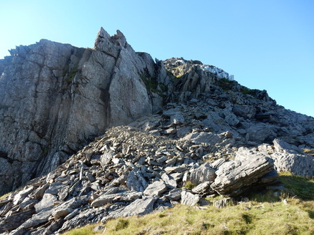 I was feeling tired now and it was getting late. I considered just heading down the path to Croesor Quarry and on down to the village. But Moelwyn Mawr didn’t look too far so I thought I would at least do that. After a wee rest on top I thought I might as well as least carry on over Craigysgafn and maybe just take the path back down from the Bwlch Stwlan. So on I went, steeply down from Moelwyn Mawr and over Craigysgafn, the steep descent of which has a couple opf scrambly moments. Now Moelwyn Bach looked ever so near and I thought, really, I might as well for all the time it would add. A direct ascent here is ruled out by a huge overhanging crag but a sneaky path avoid this to the left. It was an easy climb to the top and a delightful walk down the west ridge in a beautiful late summer evening. When you near the road the Nuttalls recommend heading right and picking up the path from Bwlch Stwlan through the woods but, having tried it, I don’t. It’s overgrown and not very pleasant. But overall what a wonderful day it had been. 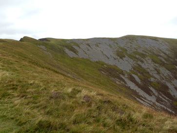 After a long, tedious drive from Sheffield, the afternoon was well under way when I got to Snowdonia so I was after a nice modest hill that would fit into what remained of it. Mynydd Mawr seemed to fit the bill so I parked myself in the Ryhd Ddu car park and off I went. The first hundred yards or so was pretty unpleasant walking on the A4085. On the way back I realised this can easily be avoided by a track round the back of the houses, very clearly marked on the map. Do pay attention, Lenman. I walked into the village, took a left onto the B4418, past Cefn Cwellyn on the right and immediately afterwards right up a track. Not far up this I notice that Cefn Cwellyn leads to a small parking spot just alongside my track and I could have chopped half an hour off my walk by using that instead. It’s a very straightforward ascent from here. The track turns into a path and you follow it all the way to the top: through the woods, steeply up onto Foel Rudd and then delightfully along a grassy ridge to the summit trig point where I stopped to take pictures and chat to a nice couple from the Wirral. 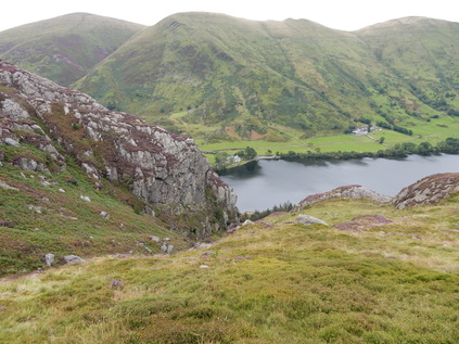 As a descent the Nuttalls recommend walking north to the col before Craig Cwmbychan and then off right down the slopes leading to the Afon Goch and down this to the lakeside. I emphatically do not recommend this descent. The slope to the Afon Goch is unpleasant, pathless, very steep and covered in knee-deep heather. And getting down the Afon Goch to the lake is not at all straightforward as it plunges into a small not very negotiable-looking gorge. I met my friends from the Wirral here who had come down another way and together, with some difficulty we found a way down a safely angled but slimy gully where a couple of steepenings were best negotiated à derrière. My trousers were not a pretty sight at the bottom. Then it is a trudge through the woods by the lake. Past the campsite, just before a house, a well-signposted path heads uphill to rejoin the path I’d come up by, painfully slowly it must be said by a frustratingly gradual rising contour in the opposite direction to homewards. Not a great return route. Maybe this hill doesn’t lend itself to a circular walk. Steve Ashton in his Cicerone Hillwalking in Snowdonia book does suggest a different one but that involves an unappealingly lengthy stretch of lorry-dodging along the A4085 all the way along the north shore of Llyn Cwellyn. Maybe better just go up and down the same way. |
|