| Jimmy Lenman |
|
 It was a very unpromising morning as I set off from the Ravenstone Lodge Hotel. Going south you can avoid the road by a path that runs along it, comprising, in its initial stage, the driveway of the rather older and grander Ravenstone Manor Hotel across the road. Immediately after this, there is a signposted bridleway heading very steeply and slipperily straight uphill (yes, bridleway - it would be a very bold equestrian would venture up here on a horse). I came down this way but missed it going up and zigzagged around on forest tracks a bit to reach the path that heads steeply up towards the ridge leading to Ullock Pike. Once I reached the ridge the mist enveloped me and I stayed enveloped for some time. Apart from the weather, it was pretty easy going to the top of Skiddaw. The final scree slope is really not bad. Following the diagonal line that ends on the 928m spot height, there is decent, clear path and it is not too steep. But I was well and truly soaked through by the time I reached the trig point. Thence I (mainly) descended easily but still very soggily past Ullock Pike to Little Man and Lonscale Fell. From there is was a rather dreary pathless trudge down and up to gain the inconveniently situated top of Sail How. The good news was it was now beginning to clear up in earnest and in the process of turning into a glorious afternoon. This was all the better news given the bad news: it’s a long way back from here.  A grassy track took me down to Skiddaw House, where I turned north on the track that leads past Whitewater Dash Falls to Peter House Farm. Sticking to this as far as the farm and finishing the walk down the road would entail an unpleasant final kilometre at the mercy of the traffic on the A591. That may be why the Nuttalls, in their guide, recommend abandoning the track about a mile before the farm and following the left side of the wall enclosing the Skiddaw access land all the way home. This I did and this I really do not recommend you do. It is rough going for a long way that seems longer, up and down, contouring uncomfortably on rough grass and ferns on what for most of the way is the faintest of paths bordering on useless. Glorious views up towards Back o’Skiddaw and across the Lake to the Northwestern Fells made it worthwhile. But if you fancy tackling all 6 Skiddaw Nuttalls in a day, I bet this isn’t the easiest way. Another time, I would do Lower Man and Lonscale Fell last, after picking off Sale How as an out and back detour. It’s about 150m of reascent but at a gentle gradient on a nice grassy track. Then, instead of going home anticlockwise, round Skiddaw, I’d go clockwise either down as far as the car park north of Latrigg then the four mile walk home through Millbeck and along the west flank of Dodd (a path on the east side of the A591 means you can avoid walking on the horrid thing as far as the starting point); or lazier still, just walk down into Keswick and get a bus home.
0 Comments
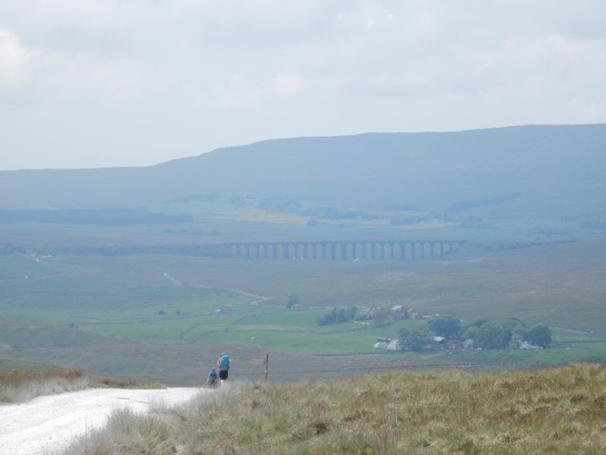 I parked in the car park at the top of the big hill the road climbs north of Oughtershaw. From here I walked downhill a little to where the OS map shows a handy corner-cutting track going off west. This track is not always very clear but I followed it nonetheless to come out on Cam High Road above Oughtershaw Side. From here the walk west to Cam End is very lovely with ever better views across the Dales until at Cam End itself there is a wonderful view over Upper Ribblesdale dominated by the Three Peaks with the Ribblehead Viaduct nestling in the middle. Not so quiet today though with plenty other walkers about even on a weekday and lots of logging activity going on the Cam Woodlands. From Cam End I followed the Pennine Way pleasantly south as far as the very lovely Ling Gill. 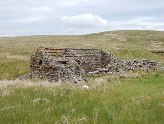 From here there is a public footpath marked on the map that heads east over moors for about a kilometre and through the forest for another to pick up a track that joins the Green Field Road. I’m guessing no one comes this way much as this path is very faint and vestigial indeed, sometimes really non-existent. Not long after it enters the woods, the “footpath” is crossed by a forestry track. At this point it had been my plan to abandon Ken Donkin, one of the walks in whose Pennine Way book, I had so far been following, and head up this track to see if I couldn’t find some way up to the trig point on top of the fell. But the Gods didn’t love me: as I’d already observed, the forestry people were busy hereabouts. The road was festooned with signs, Forestry Operations; No Public Access; No Unauthorized Persons Beyond This Point. And not just signs but people and activity. Alas, way too tresspassy. So I Donkined on, sticking to the footpath. Or not really as from here on there really was no sign of it at all and it was a matter of fighting my way along through pathless, swampy forestry using a compass to keep me in the direction the path was supposed to go. Eventually I reached the track just where it crosses a small bridge, just as the “path” was supposed to – there was a finger sign on the track but nothing it pointed to looked like a path. 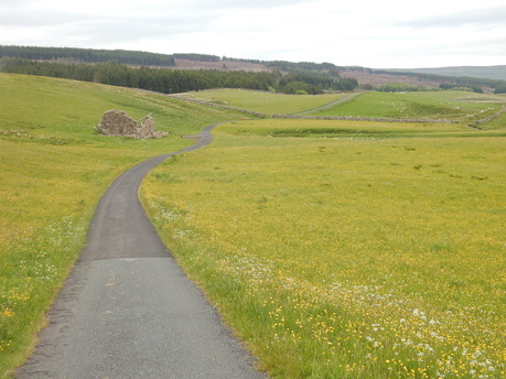 From here is gets a bit tarmacy, following Green Field Road west, through pastureland exploding with the colours of late spring flowers. The one place that offered a break from tarmac came just after Low Green Field where a public footpath heads off along a track towards Oughtershaw, cutting a corner in the road. ‘Fraid not: more signs - Forestry Operations, No Public Access, etc. Tarmacy it stayed and I took the long way round by Beckermonds. I noticed the river just below the bridge here has a big pool which would be heavenly to bask in on a hot summer day, but you would need your cozzy, the houses are too close for skinnydipping to be advisable. And it was getting a bit late with a long drive home so on I went, no stopping for a dip, on north past Oughtershaw and the long weary trudge up the hill back to the carpark. It would probably make a lot more sense to start this walk at the bottom of the hill and get the dreary climb. (Except of course there’s no car park at the bottom of the road.) 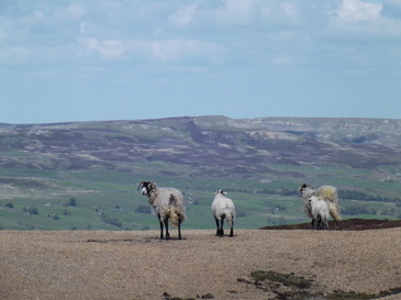 A very short walk salvaged from an idle weekend. I drove up the Long Band road towards Reeth from Askrigg, parking by the cattle grid right at the top. From here it's about a kilometer along a fency to the stone built trig point on what the OS Landranger map calls Conny Tammy Currock. The Explorer map doesn't clearly call it anything though the name Tarn Seat marks the ridge to the north. The name The Fleak also appears nearby which is the name Ian Harris's Trigpointing site applies to the trig point. It's quite a rough kilometer with some nasty groughs to negotiate at one point but it gets easier. And it's pertrty easy going to comtimue to the beacon by the same fency boave Summer Lodge Tarn, a lovely wild spot. Walking a little north from here I came to a Land Rover track which I followed easily back to regain the road a little north of where I was parked. A pleasant easy stroll on a gloriouos June day.  With Ninni. This is a classic White Peak circuit. You start at Monyash and follow the Limestone Way across pastures past One Ash Grange Farm, down into Cales Dale, up the steps at the other side, over more pastures past Calling Low Farm then down the hill to Bradford Dale; turn left and follow the Dale to Alport; cross the road and follow Lathkill Dale and the short Bagshaw Dale back to Monyash. It is beautiful at this time of year, a feast of wild flowers and birdsong. The bluebells are gone now but the red campion are out in force. Followed by a cheeseburger at the Monsal Head Hotel. 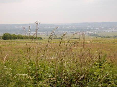 With Helen. This walk was done without any help at all from maps and guidebooks, just a few notes on a scrap of paper provided by a very nice and helpful young postdoc in the bar of Goethe University the previous evening. We caught a train from Frankfurt to Eltville and a bus from the stop by the station up the hill to the old monastery of Kloster Eberbach. From here we followed the Rheinsteig Trail west past the Schloss Vollgrads to Schloss Johannisberg. This is very easy to do as the Trail is very clearly marked at very frequent intervals with little blue and white trail markers that make getting lost almost impossible. It’s a very pleasant easy walk on good paths and roads, through woods and past vineyards. In the lovely spring weather we had, really pretty delightful. At one point we made a little detour to grab some rather tasty chips from a stall at a meeting of a some model aircraft club. At Schloss Johannisberg we stopped to taste the local Riesling. There’s a bus down the the station at Gleisenheim from here but instead we walked down the hill past the other old monastery of Kloster Johannisberg, now a hotel, to the station and easily home to Frankfurt where we ate enormous lumps of rare meat in a nice but rather pricy steakhouse in Feuerbachstrasse round the corner from our hotel. |
|