

| Jimmy Lenman |
|
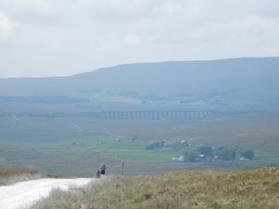
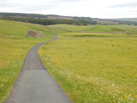
 I parked in the car park at the top of the big hill the road climbs north of Oughtershaw. From here I walked downhill a little to where the OS map shows a handy corner-cutting track going off west. This track is not always very clear but I followed it nonetheless to come out on Cam High Road above Oughtershaw Side. From here the walk west to Cam End is very lovely with ever better views across the Dales until at Cam End itself there is a wonderful view over Upper Ribblesdale dominated by the Three Peaks with the Ribblehead Viaduct nestling in the middle. Not so quiet today though with plenty other walkers about even on a weekday and lots of logging activity going on the Cam Woodlands. From Cam End I followed the Pennine Way pleasantly south as far as the very lovely Ling Gill.  From here there is a public footpath marked on the map that heads east over moors for about a kilometre and through the forest for another to pick up a track that joins the Green Field Road. I’m guessing no one comes this way much as this path is very faint and vestigial indeed, sometimes really non-existent. Not long after it enters the woods, the “footpath” is crossed by a forestry track. At this point it had been my plan to abandon Ken Donkin, one of the walks in whose Pennine Way book, I had so far been following, and head up this track to see if I couldn’t find some way up to the trig point on top of the fell. But the Gods didn’t love me: as I’d already observed, the forestry people were busy hereabouts. The road was festooned with signs, Forestry Operations; No Public Access; No Unauthorized Persons Beyond This Point. And not just signs but people and activity. Alas, way too tresspassy. So I Donkined on, sticking to the footpath. Or not really as from here on there really was no sign of it at all and it was a matter of fighting my way along through pathless, swampy forestry using a compass to keep me in the direction the path was supposed to go. Eventually I reached the track just where it crosses a small bridge, just as the “path” was supposed to – there was a finger sign on the track but nothing it pointed to looked like a path.  From here is gets a bit tarmacy, following Green Field Road west, through pastureland exploding with the colours of late spring flowers. The one place that offered a break from tarmac came just after Low Green Field where a public footpath heads off along a track towards Oughtershaw, cutting a corner in the road. ‘Fraid not: more signs - Forestry Operations, No Public Access, etc. Tarmacy it stayed and I took the long way round by Beckermonds. I noticed the river just below the bridge here has a big pool which would be heavenly to bask in on a hot summer day, but you would need your cozzy, the houses are too close for skinnydipping to be advisable. And it was getting a bit late with a long drive home so on I went, no stopping for a dip, on north past Oughtershaw and the long weary trudge up the hill back to the carpark. It would probably make a lot more sense to start this walk at the bottom of the hill and get the dreary climb. (Except of course there’s no car park at the bottom of the road.)
0 Comments
Leave a Reply. |
|