| Jimmy Lenman |
|
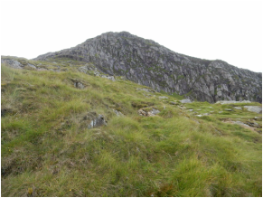
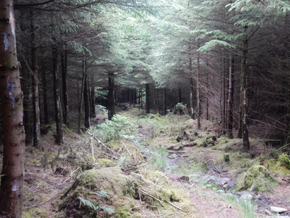
 Richard Sale's Collins Ramblers guide to North Wales proposes a route up Moel Hebog and its neighbours that begins and ends with a dose of lorry-dodging on the A4085. No thanks. Indeed, especially now the new Lon Gwyrfai path from Beddgelert to Rhyd Ddu is up and running, there is no reason, if there ever was one, to go anywhere near the main road. I started at the car park in Beddgelert near the tourist info by the station. From here I picked up the well signposted Lon Gwyfrai and followed it round the corner and up the hill, right by a farmhouse soon after which a footpath branches left up Moel Hebog. This goes straight up to the top. Its upper reaches are delightful. To call it a scramble would suggest something more exposed and airy than it is. Clambery might me a better description, needing hands in places but very never remotely tricky or remotely alarming. From Moel Hebog a slightly tedious steep descent on grass took me to the col between it and Moel yr Ogof. Glyndwr's Cave is conspicuous up on the right here but the ridge walk carries on up through a dramatic rock defile and on, very pleasantly, to the top. From here to Moel Lefn is very easy and doesn't take long.  The Nuttalls' suggested way home looked a bit of a long way round to me so I decided instead to head back to the col between Moel yr Ogof and Moel Lefn and try to pick a way down from there. This didn't go that well really. From the col to the edge of the woods is steep, rough, pathless and not very pleasant. On getting to the woods, I found a ladder stile and thought, Ah, civilisation, there must be a path down from here. But no. I could see there was a firebreak I could use to make downward progress not far away but reaching it seemed to entail struggling through thick forestry plantation for short distance. So I went for it. Thus didn't take long but it seemed to take longer and was pretty horrible. I was picking pine needles out if the skin of my neck for hours afterwards. I found followed a track SE to find the right of way path that comes down from the Bwlch Meillionen. I found this OK but it's rather a poor path, overgrown, boggy and clearly not much used. Still it took me, eventually, back to the Lon Gwyfrai and thence easily home. Another shortcut that wasn't really such a great idea.
0 Comments
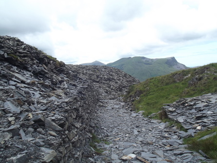 I had taken two days off walking to recover from my sprained ankle from Post Gwyn and was determined to get back on my feet today. So I took myself to the car park at Rhyd Ddu. Another pay and display. Always carry plenty of change. I booted up and set off up the Rhyd Ddu path. After about five minutes I realized I had left my refreshments in the car and had nothing with me to drink. Back I went and rectified this before setting off again. After about five minutes I realized I was wearing the wrong glasses. Back I went. Third time lucky. I sometimes fear I am too stupid to be allowed on the hills. I followed the Rhyd Dddu for about a mile and then kept straight where it goes left, heading for the col between Yr Aran and Snowdon. As I apprached this it all starts to feel a bit industrial as you walk through the old slate quarries with their huge piles of rubble. From the col Yr Aran looks a little daunting. In fact it is made easy by a good path that goes straight up from here about halfway to the top then turns left and does a devious traverse onto the east ridge that leads easily to the top following some old fence posts. 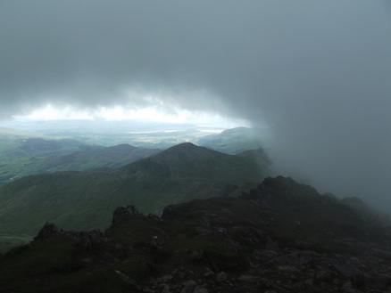 Coming down the same way, I headed up Snowdon by the South Ridge. This too is very straightforward. There is a little scrambly bit at one point but it is short-lived and very easy. Close to the top the South Ridge meets the Rhyd Ddu Path and embarks along the Bwlch Main. This is a little exposed but an easy walk on a good path. The cloud refused to lift from the top of Snowdon even though Yr ARan, Lliwedd, Crib Goch were all clear so I collected a photo - not for the first time - of the trig point surrounded by mist, then headed down. To get the Bwlch Main from the summit you follow the sign for 'Watkin'. A bit further down another sign says Watkin left, Rhyd Ddu straight on. I went straight on and followed this path all the way home with wonderful views of Mynydd MAwr and the Nantile and Meol Eilio ridges. 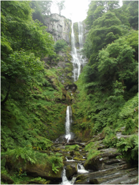 Advice to walkers heading this way. If you plan to walk up the valley of the Afon Disgynfa above the impressive Pistyll Rhaeadr, don't do so in high summer when the ferns are at their most luxuriant. The whole valley is choked with them them and my trousers were soon drenched through from lurching through them. After you pass the river coming down from Cym Rhiwiau the path, such as it is, peters out. The Nuttalls recommend sticking with the valley for another kilometer or so but I didn't fancy fighting my way through those giant ferns without a path. So my thought turned to a wall that heads left towards the plateau around here which I though might be a handy navigation aid in filthy visibility. Up I went, steeply at first, heading for the place it turns left again. A little before thus, the 1.25,0000 map has something labelled "pit (dis)". Pit there certainly was a huge hole in the ground the size of a supermarket. I walked gingerly round there of it, hoping there wee no aliens around. 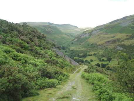 At the wall turning, the navigation gets serious in these conditions and for a big I had to pay attention. Halfway from her to the top though, the weather began to clear beautifully and all I gad to do was point myself at the now obvious cairn (which is in some disrepair and threatening to topple over soon). From here I headed SE, past some woods, over a little hill marked by the OS with a 596 spot height then SW along a fence to a point where a shiny yellow sign told me sternly not to be a motorbike. At this point, though the ground was not remotely difficult, I carelessly went over on my ankle. It hurt like crazy for a minute but then didn't trouble me much walking back, down a path then along a track back to the car park at the waterfall. But it was one of those injuries that creep up on you and a couple of hours later I could no longer walk at all. 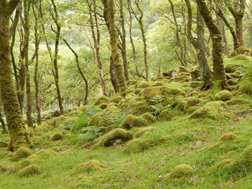 Not suitable for buses says a sign on the toad to Cwm Bychan. They're not lying: it is a long, windy, narrow road, but what a painfully beautiful place it leads to. The Roman Steps, whoever made them, are a wonderful footpath, taking you high up the hill very quickly but with little apparent effort. It is possible to leave them and head for the summit a short distanced before the col where a faint path follows a wall off right up a gully. But I carried on to the col and a bit beyond whence a less faint path leads up to and round Lln Du and up to a wall above it. 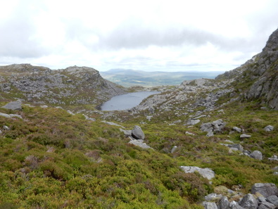 A path follows this wall (staying on the Lln Du side) south west till there is a left branch leading up the southwest ridge of Rhinog Fawr. From here I followed the main path down the SW ridge. This leads to a ladder stile by a prominent cairn. From here I was able, by keeping my wits about me, to stitch together an intricate way down to Gloyw Lyn that kept some kind of a path underfoot most of the way. A faint path follows the East Sid of the lake. From its north end a good path leads down to join the Roman Steps path not far from he car park. This is a wonderful walk through an amzing landscape that I would very happily do again and again. 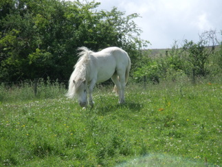 There are plenty places to park for free in Danby. I stuck myself on the grass outside the Methodist Church and headed up the road and left by the Duke of Wellington on the road to Castleton. This can soon be left to get to Castleton by the Esk Valley Walk through the woods. I went through Castleton and down Ashfield Road to take the footpath right by Brookfield Farm. This went on a bit of a loop to bypass the farm, through a field with alpacas in it. It then headed alongside a river bank through a field where I met a mare acting rather protectively towards her lovely white foal. (Yes, I know you’re not supposed to call horses “white”. So sue me.) There are a couple of other ways to get to this point from Castleton by going up to High Castleton and taking paths off to the left. Maybe those ways are nicer. This way wasn’t horrible. 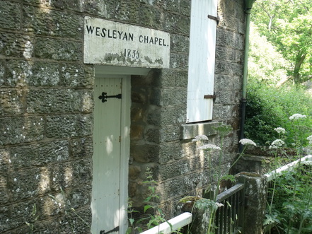 From here it’s about a mile across fields to reach Burtree Lane. One field was full of cows but they placidly ignored me the way I like them to. By the time I reached Burtree Lane I was reproaching my folly in not carrying suncream as arms were starting to burn. I had no choice but to finish the walk – in blazing sunshine – wearing my waterproof top, the only thing I was carrying with sleeves. Here I kept with the Esk Valley walk down a track past four farms, West Green Farm, Plum Tree Farm, West Cliff Farm, Blackmires Farm, to meet another road at Stormy Hill. I went left here and downhill past an old chapel and a rather smashed up phonebox to a junction where I went left at first to take a peek at Botton Village where there was a shop I thought might sell me some sun cream. The shop was shut. The coffee shop was shut. I didn’t linger but went back to the junction and along the road north to pick up the access track to East Cliff Farm. 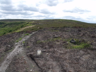 From here it is a steep pull up onto Danby Rigg, the only real climb of the day. Towards the top the path became boggy and overgrown with ferns and not all that pleasant. But I was soon on Danby Rigg itself where the walking is heavenly. I headed north, past the trig point, then down into Ainsworth and back to where I started. It had been a lovely day on a July Saturday doing what has to be a rather obvious circuit from a village right at the heart of the national park, yet in the ten miles I walked I met just one other party of three people. Maybe the lure of the Wimbledon women’s final had kept folk at home to watch Serena Williams beating Garbiñe Muguruza . 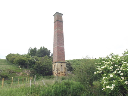 I parked in the lay-by by the phone box at Kildale then headed up the hill past Little Kildale to Warren Farm. From here a right of way leads downhill through a field to the old mine chimney in Leven Vale. “Bull in Field” says a sign on the gate of said field, alongside a little iconic representation of bovine ferocity. There was too and I didn’t care for the way that beast was looking at me as I proceeded nervously down sticking close to the fence just in case. All was well and on I went over the top of Kildale Moor and down into Baysdale where I turned left and headed east along a track. The bell heather was coming into bloom and the whole dale was alive with the furious activity of thousands of bees. At the road I stopped for a chat with a couple of friendly cyclists on a day out from Middlesbrough then south over the ford (almost dry) at Hob Hole, up the steep hill on the other side and right on the path crossing Hograh Moor. This is more or less Walk 19 from Dillon’s North York Moors book but I deviated here to visit the trig point about a Kilometer off to the south, quite rough walking on pathless ground. 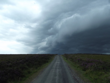 Coming down the hill past Thorntree House I saw a couple approaching on the track with some dogs in tow. As they got close I saw there were in fact an awful lot of dogs in tow, perhaps 15 or so, all off the leash and, when they a saw me approaching, charged straight at me, baying and howling. Some were quite small and not so alarming. Some were rather large. It was all a little intimidating. But they didn’t eat me, just leapt about around me. At Baysdale Abbey, which is not an abbey, just a big house were an abbey once stood, there were lots of cars parked and people sunning themselves in the garden. It’s a holiday let and must be doing OK as the road beyond was recently resurfaced. (The last couple of miles from here retraced my steps from the first couple of miles of walk 17.) As I reached the top of the hill above Baysdale Farm I heard some distant thunder rumbling. Some very dramatic forbidding clouds were forming off to my west. So I made haste back to the village hoping to make it back before all hell broke loose. Which I did. Just about. Others were less fortunate. It had been a day of stormy weather after a big heatwave the preceding week and the radio, as I drove home, brought news of two walkers killed by lightning on Pen-y-Fan. |
|