| Jimmy Lenman |
|
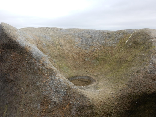
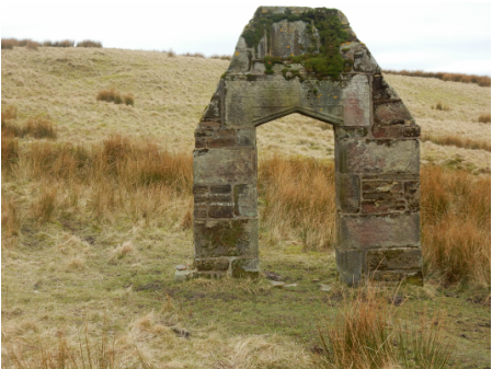
 The Widdop Road that heads NW from Slack is one of the more exciting drives to be had in the Pennines with it dramatic hairpins below the Gorple Reservoir. The summit is the 392m. spot height about a kilometre NW of the NW corner of the Widdop Reservoir. There is space here for two or three cars to park. It’s a bleak spot, chilly and windy with bare, treeless moorland stretching away in all directions. On the south side of the road a footpath is signposted going east. I would come back this way but I began by heading up the track that leads northeast, not a right of way but it is all access land now. On the map this track peters out after a kilometre and no path is shown from here to the top of Boulsworth Hill. But I thought maybe there would be one anyway and I’m happy to say there is, a decent enough path heading off right from just where the track gives out all the way to the summit trig point. Here I made a little detour east to have a peek at the “Saucer Stones” big lumps of gritstone with striking hollowed out tops. Then I walked back to the summit of Boulsworth whence a path leads downhill to the lovely track that overlooks the Forest of Trawden and here comprises both the Brontë Way and the Pennine Bridleway.  I followed this SW for a mile and a bit until it meets the minor road – Ridehalgh Lane – above Thursden. On the way here the track passes the strange arch known as the Doorway to Pendle which consists of the doorway, and only the doorway, of an old farmhouse built in 1672 and now, saving only the doorway, quite vanished. From Ridehalgh Lane the Brontë Way is signposted descending steeply through woods to meet another minor road. The Pennine Bridleway goes left here and would have taken me back to my starting point very quickly and directly. But instead I followed the Brontë Way right. It soion leaves the road to follow the Thursden Brook east and then climb through more woodland past a quarry to reach high pasture near Sweet Well House. Here I abandoned the Brontë Way and headed across a field and over a step stile to pick up the track that nears to near the top of Delf Hill. The area round the summit was populated by a quiet herd of belted Galloway cattle and some noisesome off road bikers tearing the place up. I circled both to find the trig point then headed pathlessly east over bare moorland until I picked up the Pennine Bridleway again a mile or so south of where I had left it. A very short walk north along it took me to where a good well-signposted path heads off east to where I had left my car.
1 Comment
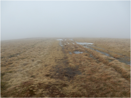 Looking at the OS map, the road west from Mosedale west past Swinside Farm towards the old tungsten mine doesn’t look very motorable. But it is, public and surfaced, till it branches where there are enough passing possibilities to go around, or at least there were today. Here I made an annoying discovery. I had left my compass in my hotel room back in Braithwaite. The tops looked misty. Oh well, I thought, with luck they will clear. If not this can be an exercise in the art of navigation sans compass. In the Cairngorms, say, that would not be too clever, but I reckoned these were not the most serious or dangerous of hills and any error I made might lengthen my walk but was unlikely to shorten my life. In fact it didn’t clear but by keeping my wits about me I found my way over four of the seven Back o’Skiddaw Nuttalls, leaving the other three for another day. It was a long trudge up pathless but fairly easy ground to the top of Carrock Fell whose gentle upper slope seemed to go on for ever. From there, there was a path to follow rather pleasantly through the mist west as far as the track that crosses the top of Hare Stones. I followed this north for a bit then headed straight uphill on my left sure that by so doing I couldn’t miss the top of High Pike. And indeed I didn’t, soon finding my way to its trig point and slightly incongruous park bench. 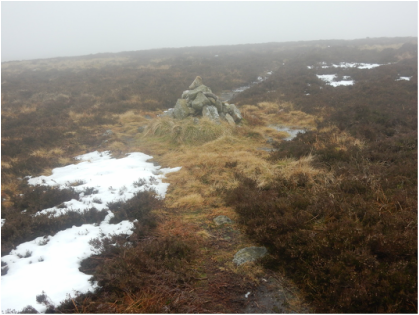 For here I took the path that leads back to the track and followed it south this time up to the top of Hare Stones where it was easy to find the tiny pile of stones – you could hardly call it a cairn – that marks the top of this most insignificant of Nuttalls. From here a decent path, not on the map, goes off diagonally right of the track to the slightly less nondescript and somewhat more cairned summit of Great Lingy Hill. The continuation to Knott and the Calvas didn’t look so straightforward sans compass so here I called it a day. Heading left to regain the track and all the way down to the old mines. I say track but it doesn’t stay tracklike long and soon deteriorates into a very muddy path. At one point I met an enthusiastic man with binoculars full of excitement at having heard his first skylark of the year, confidently announcing that it was now, in cosequence, very emphatically spring. , with not far to go disaster struck and I went into a skid on a particularly treacherous stretch of particularly squelchy ground. Landing, I went right over on my left knee. It hurt like hell. I lay there for five minutes as the pain eased thinking to myself ruefully that I knew just what would now happen. This pain will ease in the next ten minutes, I told myself, and I’ll be more or less fine the rest of today. Then overnight it will swell up leading me a hopeless cripple tomorrow and good for nothing. This prediction proved entirely accurate which is why my planned two days walking this weekend ended up being one day’s walking. Still my one day was a pleasant and straightforward walk though one for which I would recommend carryihng a compass. Do as I say, not as I do. 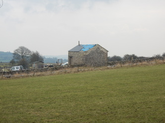 Bonsall Moor between Winster and the Via Gellia is criss-crossed by various rights of way making possible a plurality of circular walks. This is one of them. I parked in the centre of Winster and walked up the lane by the old village hall, followed it up the hill and round to the right. When it comes to the edge of the village there is a footpath off left leading a short way uphill to pick up the Limestone Way which I followed easily over high pasture all the way to Bonsall with glorious views up the Derwent valley. On Blakelow Lane south of Bright Gate Farm, some men on off road motorbikes spoilt the tranquillity competing with each other to make as much noise as possible but I soon left them behind. 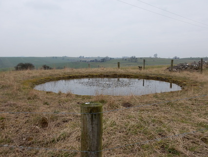 At Bonsall I left the Limestone way and took a path across fields to Slaley. Then left down a path that skirts the hillside above the Via Gellia, most of the way rather muddily through woodland. Eventually this comes to a junction with a track. Left leads quickly to the main road. I went right. The leads, at first as a track, then as a field path, all the way home to Winster, passing between Leys Farm and Whitecliffe Farm, then parallel to Bonsallmoor Lane as far as Bonsall Lane. Here a short climb took me back to where I first joined the Limestone Way and so easily back, retracing my steps, to where I started out. This is evidently cow country and in summer this walk might challenge the cow-timorous but on this chilly winter day they were all shut up indoors so I met no cows and, for that matter, very few people. |
|