

| Jimmy Lenman |
|
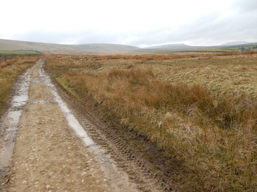
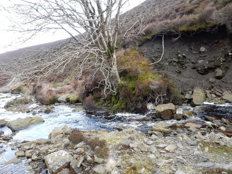
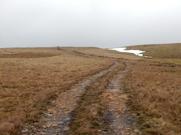
 The lady who just crossed the street told me walkers shouldn’t park there but on the grass verge just outside the village (West Scrafton). I obeyed and walked back, taking the track SE opposite the tiny Methodist Chapel. After about a mile I cut off and headed directly uphill on the left to reach Great Roova Crags where a weatherbeaten shooting lodge perches on the hilltop. The 1:25,000 OS map shows a trig point here that is missing on the 1:50.000 map. In fact, there’s no pillar but there is a bolt, a rather smaller type of survey marker these maps don’t usually bother to record. From here my target was the more straightforwardly existing trig point on Colsterdale Moor at SE119815. This was a long walk over pathless ground for about two and a half miles ESE. I took it more or less direct which wasn’t too bad apart from the unpleasantly boggy approach to Barnley Beck. From the trig point I headed SW to pick up a track above High House Farm. A track not shown on the OS 1:50,000 map avoids the dog leg to the farm and goes more directly down to the shooting lodge about a mile upstream. From here the map shows a path going west along the north bank of the River Burn and a land rover track along the south. I failed to locate the path easily and took the track, though it certainly looks from Google Earth as if there is a path all right had I looked a bit harder.  I maybe should have looked harder as taking the track meant I had to ford the river at the foot of Long Gill and it was pretty full and fast. I doubted if I would cross it dry shod but found a way, the key to which was to get myself onto a big square boulder just beyond a tree a few yards upstream. Once on top of the boulder, it’s a doddle, but getting past the tree is a very delicate manoeuvre, traversing unstable mud with bits of grass for handholds. Almost immediately after that there is the Long Gill river to cross which also took a bit of doing. Twenty years ago a bold leap would have done the trick but my bold leaping days are behind me and a gap narrow enough to cross with a pathetic incipiently geriatric leap took a bit of finding. After that it was a mercifully short but quite unpleasant scramble up vertical turf to get back onto the track.  When the track runs out at the top of the gill, which it does very abruptly the map shows a footpath leading back over the ridge to West Scafton. This also took some finding and, even when found, proved a bit ontologically insecure. I followed it, such as it was, as far as a boundary stone inscribed “E.C. Lister. Swinton” after which it seemed to give up completely. Armed with my compass I ploughed on over the pathless ground where it should have been, NW at first, then WNW, quite accurately too as I reached the fence on the ridge just at the point where it was breached by a gate. Beyond the gate a good track leads easily back to the village. These moors are a lovely place, right out on the edge of the Dales, high and lonely and very little frequented. I didn’t meet a soul between leaving West Scrafton and getting back there. I wasn’t carrying a phone and remember thinking, as I headed across the pathless heights of Colsterdale Moor, if I fell and broke my leg and had to lie there awaiting assistance from the next person to chance by, it would likely be a long, long wait. So I walked quite carefully.
0 Comments
Leave a Reply. |
|