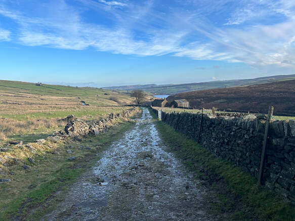
With Bella. The old favourite, Park Bakewell. Up through the alpaca field and over the golf course onto Calton Pasture. Up top the little tarn and down the other side. Through New Piece Wood to Edensor. Follow Derwent through Chatsworth Park to Calton Lees. Back up to Calton Houses and so back over pasture and home. |
0 Comments
With Bella. We parked in Grindleford by the church. We followed the lovely path up the valley to Froggatt.Then a steep climb up the hill, post the Chequers Inn and up towards Froggatt Edge. But turned off left before we got there on the path that contours along. This for a bit then down for a bit to pick up the path that heads diagonally down through the woods and so back to Grindleford. No photos.
I parked in Grindleford by the church. I followed the lovely path up the valley to Froggatt.Then a steep climb up the hill, post the Chequers Inn and up towards Froggatt Edge. But turned off left before I got there on the path that contours along. This for a bit then down for a bit to pick up the path that heads diagonally down through the woods and so back to Grindleford.
If you live in Sheffield and you want to get some exercise in the Peak District but accent got all day., the steep eastern slopes of Win Hill are the place to go. A brutally steep way up a little hill makes for a nice short but sharpish workout. I parked in the car park by the public loo on the A6103, crossed the dam and headed straight up very steeply on a tiny path got meet a track that contoured south to put me on the main path up which took ne quickly to the top. Down through the woods tho the north and round the side of the reservoir back to the dam. .
Nothing like a little lockdown to prompt a bit of exploring closer to home. I walked from Malin Bridge, a stone'sthropw for where I live, to Damflask reservoir along the south side of the River Loxley, back along the north. On 11th March 1864 the dam at Damflask broke and a catastrophic flood made its way down here top devastate a sizeable chunk of Sheffield. The path pf the south was muddy. Unrelentingly and extremely. The north side has been designated an 'easy going trail' bt the Council, with good paths and no stiles so it is doable in a wheelchair and plenty places to stop and rest. All very civilised.
With Bella. They want us to stay local so we started at Bella's front door in Kelham Island. The first bit of the walk was not terribly nice. It involved walking along the A61 or the Derek Dooley Way as this bit of it is called (Derek Dooley was a celebrated local footballer back in the day) until we reached the Sheffield and Tinsley Canal. Now the plan was simple. Out to Meadowhall by the canal towpath and back by the 'Five Weirs Way' which follows the Rover Don. As far as Attercliffe the OS shows no right of way along the canal but the towpath is open and very busy with dog walkers and cyclists. When you get to Meadowhall the way to join the Five Weirs is well signposted. We braved the indoor space of M&S to grab a sandwich. Then back by the Five Weirs. Between Stevenson Road and Attercliffe Road there was a section that was closed. We did the last curve of the river below Attercliffe Road and headed back to Kelham Island through Burngreave. I think we passed a certain amount of Industrial Heritage along the river in particular. But Bella's was my first face to face human companionship of any kind since the New Year and I was too.busy enjoying it to pay any attention to Industrial Heritage. Perhaps another time.
With Huihui and Sufang. A beautiful New Year morning. There used to be loads of parking space where the path goes off from Strines Bridge towards Foulstone Delf. But there is a little roadside parking especially by the track down to Brogging. We parked here and walked down the hill to Strines Bridge then on up the hill to Back Tor. It was very wintery and icy. the scramble to the trig point was a bit more daunting than usual. I gave it a miss - done it often enough before!. Then the long Duke's Road along Cartledge Stones Rodge, Brusten Croft Rodge, Hurking Edge and back to road nay Mortimer House. The path is mostly paved because of the bog but it was really icy and the pacing stones were treacherous so we ended up avoiding them for the boggy ground that freezing had tamed. t was beautiful and the more snow when it started to snow. And it went on snowing. We had planned a more interesting return to the car from here than just to follow the road but the snow was making me axious abut the drive home so we headed directly down the road. The 3km drive back as far as the A57 was indeed a bit hairy, Poor old Huihui and Sufang has to help with a push on one hill, But we got safely home.
I parked in Hayfield by the road between the phone box and the pay and display carpark. The south on the Pennine ridgeway which follows a pleasing route to near the top of Mount Famine. I look a wee detour too visit the top and then on to the top of South Head. A beautiful Christmas morning. And then a long walk over bog to the trig point on Brown Knoll. The ground was frozen solid which made it all easier. By the time I was approaching my next trig pointy on Kinder Low the weather was starting to close in. Something called Storm Bella was forecast to cause havoc. I had planned to carry on to Ashop Head and back bay William Clough. Instead, given the changing weather, I headed down more directly by Kinderlow End and Tunstead Clough Farm.
|
AuthorJimmy Lenman
|