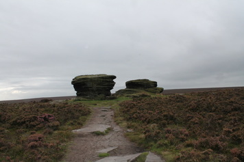
I felt like a short drive and a long walk so off to the Fox House Pub where I parked parked at the pub and took the track northeast over Burbage Moor towards Lady Canning's Plantation. Then left alongside the Plantation with the obligatory short detour to visit the Ox Stones. I kept straight on across Ringinglow Road, over the moor and through Brown Edge Farm to Fulwood Lane.
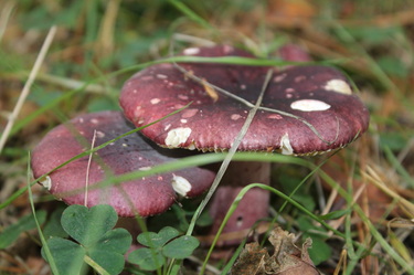
On north on tarmac past Fulwood Head and Knoll Top Farm then left on a track past sheepy fields to the edge of the easternmost of the Redmires Reservoirs. Right here then left past Wyming Brook Farm then left again on Redmires Road as far as Yorkshire Water car park. (In fact there are three groups of buildings hereabouts the OS has labelled as Wyming Brook Farm - I don't know if this is an error or if they make up a single, rather scattered farm business.) Here a footpath heads up left on an easily missed flight of steps, then northeast, then north, then northwest at first alongside and then through the woods before dropping to the road in Reddicar Hollow. I follows this north for quite a wiggly half kilometre to where a choice of paths heads west, one to the north and one to the south of a brook. I plumped for north though lovely woods, all moss and mushrooms, till a footbridge pointed the way south over Hallam moors back to the reservoirs again but now to their western extermity.
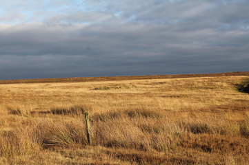
It got much busier here, with loads of dogwalkers and joggers as I headed southwest to Stanage pole then southeast to Stanage Edge where late afternoon climbers swelled the numbers further. On down to Burbage Bridge and the high path above Burbage Rocks with a beautiful sunset starting to frame Higger Tor and Carl Wark. From the map it looks like one has to brave a stretch of A6187 to regain the Fox House but a short bit of path, not on the map, cuts the corner southeast over the moor to come out just a short way east of the pub where there is a stile and an "access land" sign.
 RSS Feed
