
| Jimmy Lenman |
|
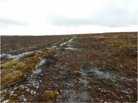
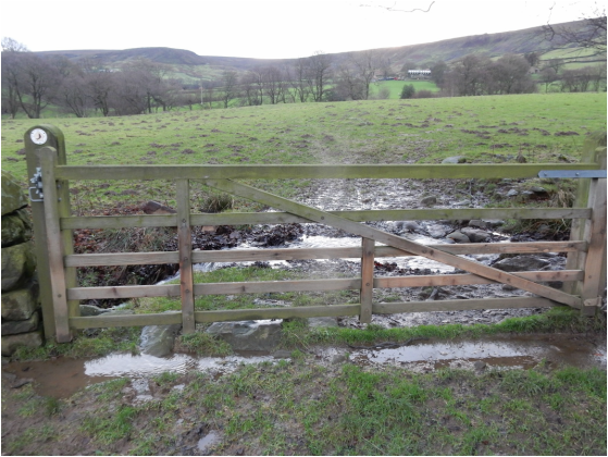
 This was in the aftermath of a lot of very bad flooding all over northern England and it showed. Approaching Westeredale there was floodwater on the road just past Kildale and there’s two fords to drive through after that both of them a bit more exciting than I’d have liked. But my engine didn’t blow up and I made it to Westerdale where I parked by the church and set off for Broad Gate Farm. Just out of the village a right of way cuts a small corner across a couple of fields. One of these was full of not very timorous sheep that decided to all rush at me together. I couldn’t tell if they were being friendly or aggressive but they were, mercifully, just sheep and permitted themselves to be gently shooed away. After the farm, where the cowsheds were heaving with cooped up beasts, the track becomes a path heading up past Dale Head and onto Castleton Rigg. A lady and her dog passed me toward the top, the only other walkers I met anywhere on this rather overcast and drizzly, if by recent standards relatively dry Sunday. Coming up to the road a sign warns drivers that the road downhill to Danby Bottom is an alarming 33%. But that wasn’t my way which lay south towards Fat Betty (the OS prefers the much duller name of White Cross). It’s a lovely high moorland road but there’s a fair bit of traffic taking full advantage of how straight it is to go rather fast so I was glad to leave it and head onto good, if thoroughly waterlogged, paths leading past the aforementioned Betty, over another road, and round Rosedale Head to meet an third road by Flat Howe a mile or so north of the Lion Inn. There was a dead sheep on the ground here, the first of four I spotted; I guess the prolonged and sometimes extreme wet weather had done the poor creatures no good.  Across the road a track marked by a big stone heads off west. It branched almost at once. I went right. From here I headed downhill past grouse butts. The track soon becomes a path – it’s marked on the map though not a right of way, but it’s access land now so it hardly matters. After the grouse butts the path more or less disappears for a while. Here Dillon in his Cicerone guide recommends looking out for, in order, a yellow-painted post, a stile over a fence, a gate in a drystone wall and for some “paint blobs and arrows leading off to the right”. I missed the post and the blobs and arrows but found the stile and the gate. After the stile the path starts to reappear and its gets easy. At the bottom you cross the stream and there’s a track leading a short way uphill to where a right branch is the Esk Valley Walk northwards which I followed most of the way home. It’s easy, well signposted, heading towards a clump of tress and, just before reaching them, branching off from the track as a path that leads straightforwardly to the access track to High House. Everything is pretty well signposted round here as the EVW heads up and round to the left of Wood End Farm to reach the access track to High House. It’s not so obvious here but you cross the track and bear left following the river bank till a footbridge crosses a tributary. Then it is plain sailing as far as the access track to New House Farm. Half a kilometre down this both the EVW and the walk described in Dillon’s book carry on north toward Hawthorn House but I took the lazy alternative following the road from here straight down past Hall Farm (more cowshedsheaving with beasts) and back to the village.
0 Comments
Leave a Reply. |
|